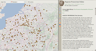
Figure 1: Places in Late Roman sources (red) and place of discovery of Roman milestones (blue) between the river Seine and Rhine, zoom level 7.
These sources have been georeferenced so when rendered on the map and receiving input by a mouse click, the source entries for the selected place will be listed in the output pane to the right. In the output pane a list of source entries for the selected place is displyed together with a citation from the source and links to digitized source editions. If the source edition is available on Google Books or the Internet Archive, you have the option to view the source inside the RFO application. Sources hosted in the Perseus digital library can also be viewed inside RFO, because they are available as XML-documents. The Peutinger database is serving small images of the map centered on the selected place, together with the transcription as part of the XML-output, see figure 2 below. The places currently on the visible part of the map can be listed by selecting the
Places menu tab. Not all sources are fully complete (especially Ammianus Marcellinus and Ptolemy), but a vast majority of the places mentioned in the other sources should be in the database. As far as I know the milestones are fully complete within the area selected. 
Figure 2: The entry of Augusta Treverorum (Trier, Rheinland-Pfalz, Germany) on the Peutinger map embedded into the RFO application.
Both layers are listed in the Layers menu tab, in the section Layers based on primary sources : Thematic layers, in the RFO application. They can be loaded following the links below.
 Places in Late Roman sources
 Roman milestones, place of discovery
Sources
Itineraries, ancient geography
- Itinerarium Antonini, in: Itinerarium Antonini Augusti et Hierosolymitanum, Gustav Parthey and Moritz Pinder (eds.), Berlin 1848. Google Books: books.google.com/books?id=s0oMAAAAYAAJ&pg=PA1
- Itinerarium Hierosolymitanum, in: Itinerarium Antonini Augusti et Hierosolymitanum, Gustav Parthey and Moritz Pinder (eds.), Berlin 1848. Google Books: books.google.com/books?id=s0oMAAAAYAAJ&pg=PA261
- Rome's World: The Peutinger Map Reconsidered, Richard J. A. Talbert, 2010. Online database: www.cambridge.org/us/talbert/talbertdatabase/prm.html
- Claudius Ptolemy Tetrabiblos, F. E. Robbins (ed.), Cambridge, Mass.; London. Perseus: www.perseus.tufts.edu/hopper/text?doc=Perseus:text:2008.01.0636
- Ravennatis Anonymi Cosmographia et Guidonis Geographica, Moritz Pinder and Gustav Parthey (eds.), Berlin 1860. Google Books: books.google.com/books?id=mlxRV1Gz1ZkC
- Notitia dignitatum omnium tam civilium quam militarium in partibus Occidentis. Seeck, Otto (ed.) 1876. Google Books-USA: books.google.com/books?id=kTmjFj4_FlkC. Internet Archive: www.archive.org/details/notitiadignitat00silvgoog
- Notitia Galliarum, in: Notitia dignitatum omnium tam civilium quam militarium in partibus Occidentis, Seeck, Otto (ed.) 1876. Google Books-USA: books.google.com/books?id=kTmjFj4_FlkC&pg=PA261. Internet Archive: www.archive.org/details/notitiadignitat00silvgoog
Narrative sources
- Rerum Gestarum, Ammianus Marcellinus [391]. Perseus: www.perseus.tufts.edu/hopper/text?doc=Perseus:text:2007.01.0081
Milestones
- Corpus Inscriptionum Latinarum III. Inscriptiones Asiae, provinciarum Europae Graecarum, Illyrici Latinae, Th. Mommsen, 1873. Clauss-Slaby Online database: www.manfredclauss.de/gb/index.html
- Corpus Inscriptionum Latinarum XIII, 1904. Clauss-Slaby Online database: www.manfredclauss.de/gb/index.html
- Corpus Inscriptionum Latinarum XVII, pars II. Miliaria provinciarum Narbonensis Galliarum Germaniarum, G. Walser (ed.) 1986. Clauss-Slaby Online database: www.manfredclauss.de/gb/index.html
- Corpus Inscriptionum Latinarum XVII, pars IV, fasc. I Miliaria provinciarum Raetiae et Norici, A. Kolb, G. Walser, G. Winkler (eds.) Clauss-Slaby Online database: www.manfredclauss.de/gb/index.html
- L'Année Épigraphique (periodical). Clauss-Slaby Online database: www.manfredclauss.de/gb/index.html

 Selected Wikipedia articles in English, French, German and Dutch with historical or archaeological content. Currently, 867 places have one or more Wikipedia article. Typically, the Wikipedia articles selected here refer to an ancient place known by name, or a major archaeological site. Load this layer by clicking
  Selected OSM geometries (point or polygon). Currently 450 places have one or more OSM geometry. Archaeological sites and remains are typically described by a point or a polygon outlining the site or ruin. Load this layer by clicking
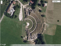
  Archaeological remains visible on Google satellite images. Currently there are almost 200 sites in the database. The quality of the images vary. Clicking the provided link in the result pane will embed the Google satellite map at zoom level 16. Load this layer by clicking
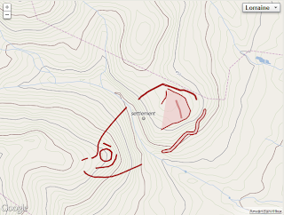
  Archaeological remains defined on the Cartes IGN (France). Currently there are 107 sites in the database. Clicking the provided link in the result pane will open the topographic map of France in a new tab or window. Load this layer by clicking
  This layer contains all the articles of the Princeton Encyclopedia of Classical Sites (PECS) concerning ancient places and archaeological sites in modern Austria, Belgium, France, Germany, Hungary, Luxembourg, Netherlands, Switzerland, and a couple of places elsewhere, in all over 700 places. The Perseus digital library that hosts the encyclopedia outputs articles and source texts in both XML and HTML. This makes it possible to embed the article inside the RFO application, which is of course very convenient. Load this layer by clicking
  This layer contains links to a growing number of entries in the topographical dictionary of Belgium, Netherlands, Luxembourg and adjacent provinces in France and Germany. I have selected places with evidence in sources no later than A.D. 950. The dictionary also contains places that are mentioned later during the Middle ages. This electronic resource from the University of Antwerpen is based on the


